Sentinel-2 L2A 120m mosaic is a derived product, which contains best pixel values for 10-daily periods, modelled by removing the cloudy pixels and then performing interpolation among remaining values. As there are some parts of the world, which have lengthy cloudy periods, clouds might be remaining in some parts. The actual modelling script is available here.
Basic facts about the data:
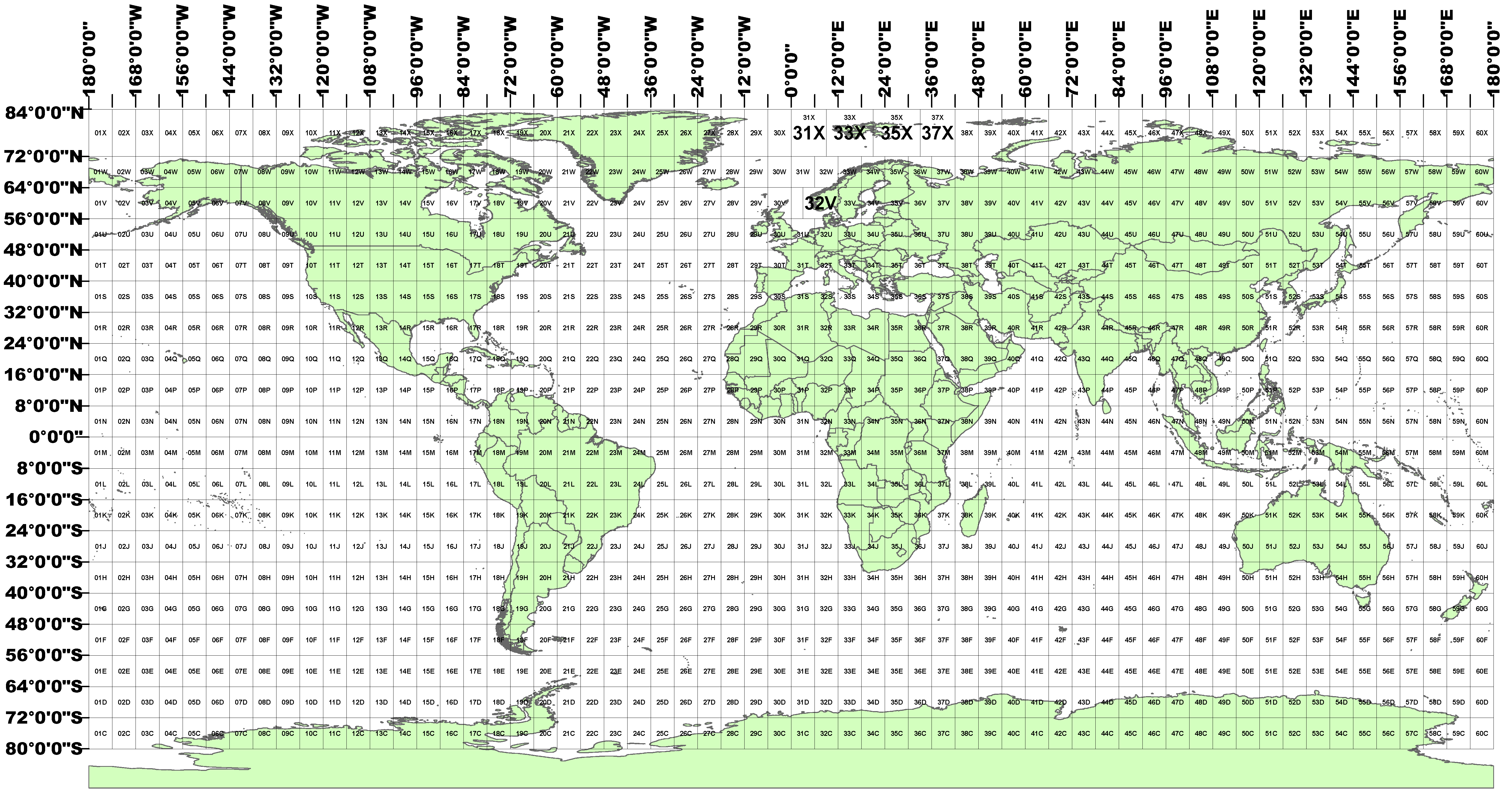
Each file is its own object in Amazon S3. The data are organised per tiles using the Military grid system. The basic data format is the following:
[year]/[month]/[day]/[UTM code][latitude band]/DATA
For example, the files for individual scene are available in the following location:
s3://sentinel-s2-l2a-mosaic-120/2020/10/12/01G/
Where:
[year] = e.g. 2020 - is the year the data was collected.
[month] = e.g. 10 - is the month of the year the data was collected (without leading zeros).
[day] = e.g. 12 - is the day at the beginning of the 10-daily period (without leading zeros).
[UTM code] = e.g. 01 - grid zone designator.
latitude band = e.g. G - latitude band are lettered C- X (omitting the letters "I" and "O").
DATA - data for each tile are organized per bands (B02.tiff, B03.tiff, etc.)
If you use the AWS Command Line Interface, you can list data in the bucket with the “ls” command:
aws s3 ls s3://sentinel-s2-l2a-mosaic-120/ and aws s3 ls s3://sentinel-s2-l2a-mosaic-120/
If you have questions about the data, please use Sentinel Hub forum
CC-BY 4.0
Credit: Contains modified Copernicus data [year] processed by Sentinel Hub